ADMINISTRATIVE REPORT
Date: September 22, 2003
Author/Local: Don Klimchuk / 7345
RTS No. 3318
CC File No. 5553
Meeting: October 7, 2003
TO: |
Standing Committee on Transportation and Traffic |
FROM: |
General Manager of Engineering Services |
SUBJECT: |
2003 Travel Time Study |
RECOMMENDATION
That TransLink be requested to repeat their Travel Time Study on a regular cycle of 5 years or less, as a means of providing timely input into the transportation planning process.
COUNCIL POLICY
The City of Vancouver Transportation Plan (1997) includes Policy 3.10.1 which states the Engineering and Planning departments will undertake regular monitoring and reviews of transportation services and use, to establish how transportation patterns are developing, and to recommend additional policies and measures needed to achieve the Transportation Plan policies and targets.
On June 22, 1999, Council approved an improved transportation monitoring program to assist with implementation of the Vancouver Transportation Plan. Among the recommendations was requesting that TransLink (Greater Vancouver Transportation Authority) undertake regional monitoring, including studies regarding travel time.
SUMMARY
Both the City and TransLink collect a variety of transportation data. This data is important for understanding how the transportation system is operating, from observing general trends, to reviewing the functioning of individual corridors or intersections. An area that both the City and TransLink have identified as needing updating is the collection of travel time data.
Travel times are used as an indicator of congestion on the arterial road network. Congestion has a number of negative impacts including increased fuel consumption and air pollution, and decreased effectiveness of transit bus and goods movement operations. Travel time data can also be used to improve the accuracy of regional emission and transportation forecasting models. Accordingly, the information generated both directly and indirectly from the travel times helps guide decisions on transportation and land use, from the policy level down to determining the most effective infrastructure improvements at specific locations.
It has been several years since any local data on travel times has been collected. The most recent study of travel time in the region is a 1987-1988 study of Vancouver arterials that was carried out by the City. The City has recognized that large periodic transportation surveys like this are most effective and meaningful when carried out at the regional level.
Accordingly, the City has encouraged TransLink to take on studies such as this, in cooperation with municipalities.
TransLink has initiated a regional travel time study as part of its current work program. Their 2003 Travel Time Study will record vehicle travel times along regionally significant roads in Greater Vancouver. A number of Vancouver corridors are included and funded in the TransLink study. To provide more complete information on Vancouver streets, staff have made arrangements with TransLink to collect data on additional Vancouver corridors. It will be necessary for the City to reimburse TransLink for their costs for these extra Vancouver routes. The estimated cost of $20,000 is significantly less than what it would have cost the City to collect this type of data on its own. It will be funded from within Engineering's existing 2003 Operating Budget. Existing budgets will also be used for some additional data collection by the City, to supplement the data obtained by TransLink.
To update and benchmark transportation trends, it is desirable to carry out studies such as this on a regular cycle. Staff are recommending that TransLink repeat their travel time studies on a 5-year cycle, or more frequently if the results of the current study demonstrate a need.
PURPOSE
The purpose of this report is to inform Council about the 2003 Travel Time Study that has been initiated by TransLink, including the collection of some additional travel time data for Vancouver. This report also recommends that TransLink be requested to repeat this study on a regular cycle of 5 years or less.
BACKGROUND
The City's 1997 Transportation Plan noted that regular monitoring helps Council establish the priority for transportation measures. Policy 3.10.1 in the Plan supports undertaking regular monitoring and review of transportation services and use, to establish how transportation patterns are developing. In 1999, Council approved the recommendations in a report back from the General Manager of Engineering Services for an enhanced transportation monitoring program. Some of the key elements of the report were:
· A recommendation that TransLink be requested to undertake regular regional transportation monitoring.
· Travel time is a key performance indicator of the road transportation system (most importantly transit and goods movement).
· A suggestion that TransLink conduct, and coordinate with municipalities a comprehensive region-wide travel time survey every 5 years, with municipalities sharing the cost of data collection on their streets.
To date, TransLink has published a number of monitoring reports. A regional travel time study would complete the first cycle of major regional transportation monitoring initiatives that were suggested by the City.
DISCUSSION
Use for Travel Time Data
The main use for travel time data is gaining a better understanding of congestion in the road network, including commuting times between major activity centres. This is important for maintaining a sustainable transportation system, since congestion can have a number of negative impacts such as:
· increased fuel consumption and air pollution (including greenhouse gases),
· decreased effectiveness and efficiency of priority modes that share roadways (i.e., public transit buses and goods movement fleets),
· increased short-cutting on local streets,
· increased (but usually less severe) accidents,
· increased commuting times for accessing important activity centres, such as business districts, airports and universities.
· increased variability of travel times for all road users, and
· increased wear on vehicles.
Travel time data is an important complement to other transportation data that is collected by the City and TransLink. It allows comparisons to be made for trips made at different times during the day or week on a corridor, and changes on a corridor over time (where data was collected in previous years). It also allows for differences in travel time times on similar corridors to be examined (i.e. two corridors leading to the same destination, or an arterial with both HOV and general traffic lanes).
Unlike some transportation data such as mode shares or vehicle volumes, travel times are easily understood by the public since every automobile trip involves some estimation and monitoring of travel time. This makes travel times a useful tool for increasing public awareness of congestion, and its environmental, economic and social impacts.
Other important benefits of collecting travel time data include the following:
IMPROVED ESTIMATING OF TRANSPORTATION EMISSIONS
Vehicles are the largest single source of air pollution in the Lower Mainland. Estimation and analysis of air pollution is carried out by the Greater Vancouver Regional District. One of the key inputs into their emission model is average travel speeds. Accordingly, average speeds which are generated from the Travel Time Study data, will be used to help calibrate TransLink's regional emission model and improve the accuracy of its forecasts.
TRANSPORTATION MODELLING
Travel time data will be used to calibrate the regional transportation computer model (EMME/2), which helps maintain the model's accuracy. The model is used for forecasting future changes to the transportation system, including those from residential and employment growth, new land uses, additional transportation supply (i.e. a new SkyTrain extension) and new transportation demand management measures (i.e. increased parking charges).
TRANSIT SYSTEM PERFORMANCE
Although the Greater Vancouver region benefits from transit services that are separated from the road system such as SkyTrain and SeaBus, the majority of transit trips take place on buses which share the road system with general traffic. Accordingly, it is important to understand the impacts that congestion on bus corridors has on transit service and ridership, and how competitive transit travel times are with automobile travel times.
TRANSPORTATION DEMAND MANAGEMENT (TDM)
Travel time data can be used to help show where modes such as walking and cycling are attractive alternatives to driving, or where the most effective locations might be for TDM measures such as High Occupancy Vehicle (HOV) lanes for car-pooling.
CITY TRANSPORTATION PLANS
Travel time data will assist with various aspects of implementing the City's transportation plans (i.e. impacts of proposed intersection improvements, understanding the source of neighbourhood short-cutting problems, helping to maintain an adequate quality of access for goods movement, etc.).
Travel Time Study Methodology
The City has carried out its own travel time studies in the past, with the most recent one being the "1987-88 Travel Time Study" ( published in 1989). Typically, a travel time study records vehicle travel times along selected arterial routes, including delays at congested locations. Data is collected by having cars drive selected routes, following the general flow of traffic, while the elapsed time is recorded. Several trips along each route (usually about 6) are required to provide an accurate estimate of the average travel time.
TransLink 2003 Travel Time Study
TransLink's Strategic Planning Department began data collection at the beginning of September this year, and expects that the data collection phase will last about 3 months. Once all the data has been collected, it will need to be checked, processed and summarized. Study results are planned to be reported in Spring 2004.
Information will be similar to that collected by the City in its past studies. However, the methodology for collecting data will utilize new technology. For each route, TransLink will use a driver in a car equipped with a Global Positioning System (GPS) and an electronic recording device. This allows the travel time data to be automatically logged and loaded into a computer database, resulting in a significant reduction in labour costs and sources of error. Unlike past methods, a passenger is not required to manually transcribe the data, nor does the data have to be manually entered into a computer system. The high resolution data will also allow for the estimation of queue lengths at the approaches to major intersections on the corridors that are surveyed.
The time periods monitored will include the following:
MONDAY TO FRIDAY (all routes)
- morning peak (7am-9am)
- mid-day period (11am-1pm)
- afternoon peaks (3pm-6pm)
WEEKEND (selected routes only)
- Saturday mid-day peak (12pm- 2pm)
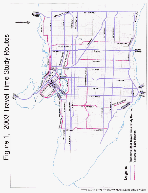
Vancouver routes included as part of TransLink's study cover important regional corridors (i.e. Granville, Hastings, Broadway, etc.) and are shown in Figure 1.
Although GPS technology is an effective method for acquiring travel time data, currently it has some limitations in areas where there is a dense number of high-rise buildings, such as the Central Business District. The GPS signal is weakened due to the canyon effect of the building exteriors, resulting in reduced accuracy or intermittent loss of the GPS signal. Accordingly, TransLink's 2003 study is not scheduling collection of data for a number of streets in the downtown's Central Business District where GPS signals are expected to be weak. As described in the following section, the City will need to do its own data collection to complete some of the data for Downtown.
Additional Vancouver Data
As a supplement to their 2003 Travel Time Study, TransLink offered municipalities the option of adding extra local routes, if municipalities fund the extra costs. Accordingly, staff have made arrangements with TransLink to collect weekday data on extra Vancouver routes. This will allow a better understanding of changes since the City's 1987-1988 study and include corridors that are important to Vancouver neighbourhoods. The additional data collection will be recorded, managed and processed by TransLink. The extra Vancouver routes are also shown in Figure 1.
Because of the limitations in GPS technology, not all of the routes of interest to the City will be included in the data collected through TransLink. Accordingly, some extra data collection by the City will be required to fill the gaps, using a driver and a passenger to manually record the data. Data for priority locations, such as Downtown one-way streets that are going to be converted to two-way, can be collected by the City using existing budgets.
Existing budgets will also be used to collect additional data that will help provide further understanding of travel times in Vancouver:
1) Parking Lot Circulation Times
To provide a more complete picture of actual automobile travel times, staff will sample a collection of local parkades to evaluate parking lot circulation times. This will be used to provide a more complete indication of door-to-door motor vehicle travel times.
2) City Bus Lane Time Savings
In recent years, the city has provided bus lanes on various corridors to help improve the effectiveness of bus service. Staff will document the bus travel time savings on corridors
which contain both bus lanes and general traffic lanes.
Staff will report back on the results of the additional Vancouver data collection in Spring 2004, as part of their report back on the 2003 Travel Time Study results.
FINANCIAL IMPLICATIONS
TransLink has estimated the cost of data collection for additional Vancouver routes to be $20,000. Funding to cover this amount has been identified in Engineering's existing 2003 Operating Budget. The expenditure of $20,000 represents good value for the City. Coordinating City data collection through TransLink, results in significant savings in costs for temporary staff collecting data, vehicle expenses for collecting data, existing staff time for managing the project, and for purchasing equipment. If the City carried out its own Travel Time Study on similar routes, it is estimated it would cost the City at least 4 times this amount. As well, the City has also benefited by having TransLink research and develop the project.
Staff recommend that the study be repeated on a regular cycle of 5 years or less, with TransLink continuing to take the lead role in data collection and processing. TransLink's cost to carry out this study is approximately $250,000. As well, they have dedicated considerable staff and consulting time for researching and developing the study process. In future study years, similar City operating budget impacts can be expected to update the Vancouver component of the Travel Time Study.
CONCLUSION
Travel times and the identification of congestion points are one of the key indicators of the performance of the City and regional arterial road system. This data will help provide a better understanding for planning and operation of priority modes such as transit and goods movement, and help with identifying and monitoring measures to reduce transportation related emissions, including greenhouse gases. Accordingly, it is recommended that the City encourage TransLink to continue performing travel time studies on a regular cycle of 5 years or less.
* * * * *